If you search for flood plain maps on Environment Canada’s website, you’ll find they’ve been archived and the most recent map was made in 1996, for Calgary.
The outdated mapping is a result of budget cuts by the Federal Government which shut down the Flood Damage Reduction Program, ending Environment Canada’s leadership on flood risk plans.
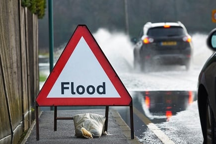
Learn more about flooding insurance here.
In the private sector, the most recent national flood plain maps come from Esri-Canada, dated 2012.
The calls from within and outside the government for modern overland flood maps in Canada are being dampened by developers and politicians benefiting from our ignorance to flood risk.
Register for the 2017 Flood Risk Summit
That’s according to Dr. Blair Feltmate, the University of Waterloo’s head of the Intact Centre on Climate Adaptation who’s speaking at the 2017 Flood Risk Summit brought to you by Aviva.
“Many people and organizations agree we need up to date flood plain maps, the question is why don’t we have them? Why don’t they exist?” Feltmate asked.
“The limitation isn’t cost, it would cost about $1 million to produce up to date and future focused flood plain maps for large and small communities in Canada. Relative to the cost the federal government pays out when floods occur, $1 million is pretty dinky.”
According to the Parliament Budget Officer, the federal government’s approximate Disaster Fund Assistance Arrangement cost $160 million for heavy rains in Saskatchewan, $120 million for the Toronto ice storms, while southern Alberta and southeastern B.C. were expected to receive $1.35 billion.
Want the latest insurance industry news first? Sign up for our completely free newsletter service now.
“Flood plain maps are politically toxic, nobody wants to take the lead in developing them and to release them publicly,” Feltmate said.
“Governments that would support developing flood plain maps would take a lot of heat from current home owners who may be now identified as being in a flood plain. All of a sudden you have a $1 million home that is stigmatized and devalued down to half its current value where it’s unsellable.”
Developers who’ve bought land in a flood plain will become aggravated should a flood plain get released and the question of who will pay to de-risk flood plain communities would become an issue, according to Feltmate.
“They (developers) have, perhaps, a $30 million investment that’s now very much in limbo as to whether they can even build properties on it,” Feltmate said.
“Or we have mayors and councilors, who for budgetary purposes want to build homes to realize the property tax revenue basis associated with those homes. But, if they planned a few thousand homes in a region that is now designated as a flood plain and they can’t do that anymore, their whole budgetary planning may go right out the window.”
Related stories:
Fort McMurray residents ‘taking extravagant vacations’ after insurance payout
The future of Canadian flood insurance


