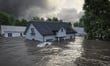
New development in Victoria’s highest-risk flood zones will face restrictions under mandatory flood planning provisions gazetted by the Victorian government, replacing a discretionary framework that the insurance industry had argued led to inconsistent decisions across councils.
The reforms introduce a Flood Risk Rating (FRR) system with five tiers, from FRR1 (low) to FRR5 (extreme). Each rating carries corresponding planning and building controls, according to the Victorian Department of Transport and Planning.
At the top end, FRR5-rated land is classified as areas where development is “generally inappropriate” and natural floodplain function must be protected. FRR4 (very high risk) areas will see development “generally recommended to be avoided.” Lower-rated zones face scaled requirements, with FRR1 areas managed through minimum building standards alone.
The Insurance Council of Australia (ICA) backed the reforms, having called for mandatory rather than discretionary rules in its submission on the draft guidelines.
The case for mandatory rules was reinforced by a Victorian Ombudsman investigation published in November 2025. That report found that rushed and flawed flood modelling by Melbourne Water, combined with building plan errors from the early 2000s, led to the Rivervue Retirement Village being constructed in a flood hazard area. Residents were left “significantly out-of-pocket” after the 2022 Maribyrnong River flood, the Ombudsman found.
A separate analysis by law firm Maddocks noted that the October 2022 floods affected 81% of Victoria’s local government areas. The firm warned that outdated flood mapping in planning schemes creates litigation risk for councils if developments are approved in areas not mapped as at risk.
Under the new mandatory system, councils will have less discretion over how flood risk ratings are applied.
Read more: Government resists Ombudsman’s call to compensate underinsured flood victims
For brokers, the core question is whether better flood data will flow through to more accurate pricing. The ICA has called for updated flood mapping to be shared with insurers via Risk Frontier’s National Flood Information Database, which would allow premiums to reflect property-level data rather than broad area-based assessments.
The experience in Wagga Wagga shows that the link between mitigation and pricing is not automatic. Despite a $23 million levee upgrade completed in 2020 giving the CBD protection to a 1% annual exceedance probability, some homeowners saw renewal premiums jump from around $700 to nearly $9,000. A broker’s quote for one Wagga CBD property exceeded $15,000, compared with under $5,000 for a property in Shepparton, which flooded in 2022.
By contrast, in Roma, Queensland, Suncorp cut property premiums by an average of 45% after an initial levee was built following the 2012 floods.
The broader affordability picture adds context. Home insurance premiums rose an average of 7.2% annually from 2010 to 2025, against 3.1% annual wage growth, according to the Australian Prudential Regulation Authority’s (APRA) March 2026 Insurance Climate Vulnerability Assessment (CVA). APRA has projected uninsured households could rise from roughly one in seven to one in four by 2050.
At renewal, brokers should ask whether the flood risk component of a premium reflects current mitigation works, which data sources the insurer is using, and whether those sources include the latest flood studies shared with the National Flood Information Database.
ICA deputy CEO Kylie Macfarlane said the government had taken the right approach. “These rules mean new homes are less likely to be built in places that we know will flood, and that’s good news for all Victorians. The most expensive home is the one you build twice,” Macfarlane said.
“We know the best way to reduce the cost of future disasters and help keep insurance affordable over the long term is to stop building homes in places that will flood,” she added.
Read more: Disaster grants reveal insurers’ broader resilience challenge
Around 1.36 million Australian properties face severe to extreme flood risk, concentrated in New South Wales, Queensland, and Victoria, according to the ICA. Declared events damaged more than 145,000 homes in 2025, nearly matching the approximately 172,000 new homes completed nationally that year.
The Victorian announcement also included $36.8 million in joint Commonwealth and Victorian funding for 11 projects through Round Four of the Disaster Ready Fund, administered by the National Emergency Management Agency (NEMA). The ICA highlighted flood levees in Epsom and Rochester as priorities.
Macfarlane said the focus needs to be on consistent implementation. “Now it’s about getting it right in practice. Councils need to apply the rules consistently, insurers need the latest flood maps, and the same thinking should be applied to bushfire and other hazards,” she said.
With NSW and Queensland also reforming how planning responds to natural hazard risk, the ICA has pointed to an opportunity for greater national consistency.