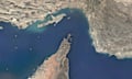
The Northland Regional Council has released its new coastal hazard maps identifying land potentially at risk of flooding from storm surge and long-term erosion by the sea.
The maps show the estimated flood and erosion hazards in 50 years and 100 years’ time, based on conservatively predicted sea-level rise scenarios of 0.4m during the next 50 years and 1.0m during the next 100 years.
“Their completion marks the end of a four-year project to update coastal hazard zones (some identified more than 10 years ago) and includes new areas identified following extensive peer-review and the use of modern topographic tools,” chairman Bill Shepherd said.
He stated that the finalised maps will replace previous coastal hazard mapping, which coincidentally comes as the central government (via Ministry for the Environment) has just released its latest guidance on coastal hazards and climate change.
“In that sense, Northland is now effectively ahead of the game in terms of identification of coastal flooding and erosion hazards,” he said.
According to Shepherd, there are nearly 13,500 potentially affected properties up and down the length of Northland’s east and west coasts. These are documented in coastal erosion hazard maps for 31 sites and coastal flood hazard maps for 63 sites where survey information is available.
“Identifying areas that could be at future risk of coastal hazards helps regional and district councils and landowners to manage risks associated with new development,” he said. “It’s about future planning for our coast and creating strong and resilient coastal communities where new buildings can withstand the test of time.”
The maps were previously released for public feedback from landowners in the mapped areas in 2016 and in mid-2017, which resulted in about 55 submissions from the 8,000 property owners contacted by the council.
Present-day coastal flood hazard risk areas have also been identified for comparison with future scenarios, Shepherd added.
Related stories:
Research on Porirua tsunamis gets EQC funding
Council considers approach to stormwater