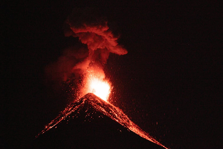
New research has revealed that Rangitoto Island, the youngest and largest volcano in Auckland’s volcanic field, continues to emit heat from solidified magma more than 600 years after its last eruption.
The findings, led by University of Auckland scientists and supported by the Natural Hazards Commission Toka Tū Ake (NHC), offer new perspectives for risk assessment and long-term planning in the region.
Rangitoto, situated roughly 10 kilometres from Auckland’s central business district, is one of 53 volcanoes in the Auckland Volcanic Field (AVF).
The study identified a weak hydrothermal system on the island, driven by residual heat deep underground.
“This is the first time we’ve detected signs of heat from volcanic activity in the AVF, but it doesn’t mean Rangitoto is active or preparing to erupt again,” said lead researcher Alutsyah Luthfian of the University of Auckland.
The research team discovered that the unerupted magma beneath Rangitoto remains sufficiently warm to heat groundwater, maintaining a hydrothermal system long after the eruption.
This challenges previous assumptions that post-eruption magma cools quickly and poses little risk to surface infrastructure.
“While we had expected the unerupted magma under the volcano to be solidified, we were really surprised that it is still warm enough to heat groundwater and drive a weak hydrothermal system, 600 years later,” Luthfian said.
The study draws comparisons to Heimaey, Iceland, where cooling lava flows powered a geothermal station for 15 years after an eruption.
In Auckland, earlier research suggested that heat from lava flows would not significantly affect underground infrastructure.
However, the new findings indicate that slowly cooling magma could provide a sustained heat source, potentially impacting infrastructure near a new volcano’s vent for years after an eruption.
“With this new data point, we can potentially map a curve of how heat disperses with time and better predict the long-term environmental and societal impacts of eruptions from Auckland’s larger volcanoes like Rangitoto,” Luthfian said.
The research is part of the DEVORA (DEtermining VOlcanic Risk in Auckland) programme, a multi-disciplinary initiative funded by the NHC and Auckland Council.
The team, which includes researchers from Université de la Réunion and GNS Science, used copper-sulphate-filled clay pots and wire to measure natural electrical voltage across Rangitoto.
The results showed increased voltage near the summit, indicating ongoing circulation of warm groundwater.
Similar voltage signals have been observed on active volcanoes such as Izu-Oshima in Japan and Stromboli in Italy.
The team also detected elevated carbon dioxide emissions on the summit and upper eastern flank of Rangitoto.
The source of these gases remains under investigation, with possibilities including the hydrothermal system or a nearby fault facilitating the rise of deep fluids.
Dr Jo Horrocks, chief resilience officer at the NHC, said: “This research is an important piece of insight into how a major eruption in Auckland might play out and heat its surroundings for many years after the fact. It’s important to invest in research in Auckland’s volcanoes, so we can know which signs to look for and prepare for the impacts from a volcanic eruption.”
In addition to volcanic hazards, the NHC has commissioned a land-use modelling system to help councils and planners evaluate how zoning and infrastructure decisions could affect future flood risk.
Developed by Market Economics’ Dr Robert Cardwell, the tool simulates how different policy approaches may influence the location and type of urban development over time.
Cardwell highlighted the importance of early risk assessment.
“Urban planning decisions are hard to reverse,” he said. “Once zoning rules are applied and infrastructure is built, the consequences last for decades. Our model helps avoid a situation where, 10 years after a development is approved, a major flood hits and people ask, ‘Why was this allowed in a floodplain?’”
The model does not predict specific housing locations but analyses development drivers such as accessibility, surrounding land uses, and population growth to identify areas at risk and potential mitigation strategies.