A record-strength El Niño is developing months before its expected peak, testing how far New Zealand’s insurers and risk advisers can rely on previous events to assess the approaching summer.
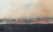
The immediate exposure is unlikely to be uniform. Dry soils and stronger winds are increasing wildfire danger in northern and eastern areas, while western regions face heavier rain, storms and flooding. That divide places greater weight on the location, construction and policy terms of individual risks rather than the event’s global classification.
The temperature anomaly in the Niño 3.4 region, at the centre of El Niño, has reached 3.05°C above the 1991–2020 average. That exceeds the 3.02°C recorded in November 2015, previously the highest reading in 150 years of modern records.
The daily sea-surface temperature data is derived from the US National Oceanic and Atmospheric Administration. A rolling baseline used by many meteorologists places the current event in a statistical tie with 2015 rather than clearly above it, but both measures show exceptional warming unusually early in the cycle.
An average of 14 climate models indicates the anomaly could approach 4°C in November and December. Climate scientist Zeke Hausfather described the projected level as “mind-blowing”. An anomaly above 2°C is classified as a very strong El Niño, sometimes called a super El Niño.
“Very strong El Niño events like those in 1997/1998 and 2015/2016 were associated with hundreds of billions of dollars in damages globally—this event is leaving those past ones in the dust,” Hausfather said.
The latest New Zealand seasonal outlook said the event was already comparable with 1997 and had shown the strongest warming trend on record.
Westerly and southwesterly airflow is expected to become more prominent through spring. Rainfall is most likely to remain below normal in the north and east of the North Island, while the west of the South Island has a 60% probability of above-normal rainfall and an increased likelihood of heavy rain and unusually strong winds.
That western exposure enters an already active claims environment. IAG’s latest Wild Weather Tracker recorded 46 storms and 33,174 related claims across its New Zealand brands in the year to February 2026. That was a 256% increase from 9,324 claims arising from 29 storms a year earlier.
In eastern regions, below-normal winter rainfall has reduced groundwater recharge, while further dry spells are expected to accelerate the drying of soil and vegetation. Rural, forestry, lifestyle block and peri-urban properties face the clearest wildfire implications.
Unlike earthquakes, landslides and several other hazards, an ordinary wildfire does not attract first-layer cover from the Natural Hazards Commission. The scheme covers fire only when it results from one of its specified natural hazards, leaving standalone wildfire losses with private insurers.
The potential severity is established even without a record El Niño. Insurance Council of New Zealand data shows the 2020 Lake Ōhau fire generated $35.2 million in insured losses from 230 claims. The 2017 Port Hills fires produced $18.3 million from 197 claims, while the 2019 Tasman District fires added almost $4 million.
The resulting exposure depends partly on policy structure. A recent comparison of rural fire policy wordings found that Vero and FMG require fencing fire cover to be scheduled or deliberately selected. AMI includes fencing against fire under an automatic extension in its rural material-damage policy, although that extension excludes flood damage to fences.
Those distinctions become more consequential when opposite sides of the country face different perils. A policy suitable for an eastern property’s fire exposure may still leave gaps around fencing or other rural assets, while western properties may require closer attention to flood, storm and business-interruption limits.
The intensity of El Niño does not determine losses at any particular location. Earth Sciences New Zealand estimates that the cycle accounts for less than 25% of year-to-year variation in seasonal rainfall and temperature across most of the country. Local pressure systems and other climate drivers will continue to shape where damage occurs.
The wider uncertainty comes from the warmer climate in which the event is developing. Imperial College London professor Friederike Otto said the resulting extremes could move beyond previous experience: “So, in many places around the world we will see never-before-experienced heat extremes, with all their consequences on health, food security and water stress.”