The questions to be investigated include:
The Porirua City Council teamed-up with the EQC to co-fund the project. It is one of the first in New Zealand to ask for precise information on where and how a tsunami is likely to flow, GNS scientist and research team leader Wendy Saunders said.
“There is a ‘tsunami line’ and that’s good for evacuation, but it doesn’t tell you the detail of how the water is likely to flow around the contours of the area, or how it is likely to run back into the ocean,” she noted.
According to Saunders, there are already guidelines funded by EQC in 2011 for councils to integrate tsunami risk into their planning process.
“Since the Japanese tsunami that same year, we have learnt so much more about how tsunamis behave on land that an update to the guidelines is needed. We also learnt from Japan that to help people be safe, you can’t rely on warnings once a tsunami happens, you need to have evacuation plans and use land use planning to lower risk beforehand,” she said.
“Here in the Wellington region we’ve now got a lot of good data from the ‘It’s our Fault’ project looking at natural hazard risks in the area. That, combined with Porirua land data and new modelling technology, means we should be able to give an assessment of tsunami risk at a much more precise level.”
Saunders also said that the project is not necessarily about stopping development in areas inside a tsunami evacuation zone; rather it’s about getting smarter about what buildings are put where, and reducing the risks to people.
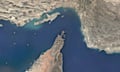
“Though you don’t immediately think of Porirua City as high tsunami risk, it has a lot of coast and inlets that could be affected by a tsunami from faults we know about offshore in Kapiti, and a very large movement in the Hikurangi subduction zone could also affect the city,” she explained.
EQC general manager Hugh Cowan said that as well as delivering detailed maps for Porirua City to use in land use planning, the project will show other councils how they can do the same thing.
“We know that there are quite a few councils that want to understand more about tsunami risk, but haven’t been sure how to go about it,” Cowan said. “The work of Dr. Saunders and her team will be widely shared.”
EQC funds $16 million of research each year to reduce the impact of natural disasters on people and property.
Related stories:
Council adopts revised climate change assumption
EQC reveals claim numbers for February storm