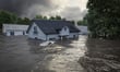
New Zealand insurance brokers are operating in a market where flood and coastal properties are becoming harder to place, earthquake scenarios carry compounding risks that existing models handle poorly, and the hazard assessment tools that underpin coverage decisions are out of date.
The Natural Hazards Commission Toka Tū Ake (NHC) is investing $3.6 million across eight university research programmes to address exactly those gaps. The programmes begin in early 2027 and run for three years.
The research matters. But the conditions it is designed to improve are already shaping what brokers can and cannot do for clients today.
At the end of 2025, AA Insurance halted new home, business, and landlord insurance policies for properties in Westport’s 7825 postcode, citing elevated flood exposure. Law firm Minter Ellison described it as the most visible sign yet that insurance retreat dynamics seen overseas are playing out in the New Zealand domestic market, and said the trend is likely to extend to other hazard-exposed areas.
The Reserve Bank of New Zealand (RBNZ) placed insurance affordability on its financial stability risk register for the first time in its May 2026 Financial Stability Report. The central bank estimated the total sum insured for New Zealand residential dwellings at around $1.5 trillion for 2024/25 and warned that “emerging pressures from insurance affordability, underinsurance, and insurance retreat from areas exposed to elevated flooding risk indicate financial stability risks may increase.”
A Consumer NZ report published in August 2025, using Stats NZ data, found house insurance premiums had risen 916% since 2000, and that the share of households cancelling insurance due to cost rose from 7% in 2022 to 17% in 2025.
According to Our Marine Environment 2025, published by the Ministry for the Environment and Stats NZ in October 2025, approximately 219,000 homes are already in flood-prone areas, representing $180 billion in assets. The same report found that by 2060, 1,300 coastal homes could face major damage from extreme events.
These are the conditions brokers are working in now.
Read next: NZ homebuyers are guessing on natural hazard risk
The NHC programme with the largest potential implications for catastrophe loss modelling is the post-earthquake fire study for Greater Wellington, led by Dr. Andres Valencia of the University of Canterbury.
The research will model how fires spread after a major earthquake in an environment where seismic damage has already disrupted the roads, water supplies, and firefighting capacity needed to contain them.
Wellington’s exposure to this combination of risks is documented but not fully reflected in current loss models. Research published in the Bulletin of the New Zealand Society for Earthquake Engineering modelled ignitions, fire spread, and suppression across five earthquake sources affecting Wellington City. Mean total fire-following-earthquake losses across those scenarios ranged from $0.28 billion for a Wairau Fault event to $3.17 billion for a Hikurangi Subduction Zone scenario. The same research identified wind speed as a more significant factor in potential losses than the number of ignitions – a finding with direct implications for a city where high winds are routine.
Wellington’s characteristics reinforce that risk. Closely spaced timber-framed buildings, steep terrain, vulnerable water infrastructure, and frequent high winds create conditions where post-earthquake fire spreads faster and further than structural damage modelling alone would suggest.
For brokers with Wellington clients, the gap between current modelled risk and the fuller picture is relevant now. What insurers and reinsurers do with the new data, when it arrives from 2030 onward, will shape the Wellington underwriting environment.
The managed retreat programme has the most direct connection to the conversations brokers are having with clients today. Led by Dr. James Miller of the University of Auckland, it will work alongside Māori and Pacific communities in Auckland and Northland to build tools for weighing whether it is better to remain in a flood-prone area, adapt in place, or relocate.
An NHC report published in December 2025 on the roles of insurance in managed retreat found that insurance availability and affordability already determine whether managed retreat is financially viable for many households, and that new insurance structures may be needed to help fund relocations.
For brokers, the managed retreat question is not abstract. It bears directly on whether a client’s property can be insured, financed, and sold.
A programme led by Prof. Mark Dickson of the University of Auckland will use drones, imaging technology, and computer modelling to identify what makes coastal cliffs unstable and improve how clifftop hazards are assessed.
The New Zealand government’s Settled property guidance notes that insurers are already reassessing how they cover clifftop properties as coastal risks increase and advises prospective buyers to establish whether such properties can be insured before purchasing.
Better collapse data will eventually refine how insurers price and underwrite these properties. Until it does, brokers placing clifftop risk are working with the same incomplete information as the market.
Read next: El Niño to outlast 2026 as Pacific drought and flood risk mounts
Five further programmes cover earthquake retrofits for older apartment buildings, housing vulnerability for different home types including Māori housing and papakāinga, floodplain development decisions using Hawke’s Bay’s Tūtaekurī floodplain as a case study, disaster recovery times for homes, and updated national earthquake hazard mapping led by Prof. Brendon Bradley of the University of Canterbury, building on six years of prior NHC-funded work.
NHC Head of Research Dr. Natalie Balfour said: "Every dollar we invest in understanding natural hazards and reducing risk today has the potential to save homeowners and the country many times that amount in future."
The Insurance Council of New Zealand’s (ICNZ) 2025 Annual Review reported total insurance claims across all lines of $3.8 billion and noted global insured losses from natural catastrophes exceeded US$100 billion for the sixth consecutive year.
The NHC research will not change those numbers. What it may do – from 2030 onward – is give underwriters, reinsurers, and the brokers between them better information with which to price what New Zealand actually faces.