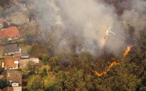
There’s nothing more traumatic than fleeing a wildfire and knowing it’s going to devour your precious home. All your lifelong memories are about to be burned to the ground thanks to Mother Nature.
That’s the harsh reality hundreds of Californians are facing after America’s worst wildfire season ever recorded. The historic 2017 blazes torched hundreds of thousands of acres, and destroyed more than a thousand properties, many of which were family homes.
And there’s one more potential kick in the teeth for these devastated families. Fire-gutted communities are ripe picking grounds for heartless criminals focused on cashing in on other people’s misfortunes.
“Criminals have been known to walk through burned out neighborhoods on the hunt for loose safes and other valuable items that survive fires. They steal the items, crack the safes, and sell things on – and there’s nothing the families can do about it,” said Jono Millin, co-founder of drone mapping software start-up DroneDeploy.
“That’s where drone technology comes in. Drones can be flown over burned out neighborhoods to create high-resolution photo evidence of an area almost immediately after an event like a wildfire. This can be vitally important when it comes to wildfire claims. If, for example, a criminal was to enter a burned out neighborhood and steal a bunch of safes, our DroneDeploy solution would give the homeowners evidence to use at claim time to show the safes were there and survived the fire.”
However, there’s also a potential negative to such on-demand high-resolution imagery, which companies like DroneDeploy need to be wary of. While drone technology is providing imagery for homeowners and authorities, it’s also potentially feeding criminals with information on key target areas. During the 2017 wildfires, DroneDeploy was asked by the Californian authorities to withhold their imagery for a short while to prevent this problem.
DroneDeploy has the largest drone data platform in the world. It was heavily involved in the North American natural catastrophes last year, helping to dramatically speed up the claims process and get victims of the disasters back on their feet as soon as possible.
The company helped Californian authorities to establish the state of affairs quickly after the wildfires abated. Authority-owned drones running DroneDeploy software were able to generate 2D maps and 3D models, identifying key problem areas, burned out cars, damaged properties and debris.
“A lot of people ask: what about satellite data or manned aircraft? The problem is, they’re more susceptible to bad weather and dangerous situations,” Millin told Insurance Business. “Satellites can’t see well through clouds. If you think about the smoke generated in the California wildfires or the thick overcast clouds after Hurricane Harvey – they caused problems for satellites. You sometimes have to wait weeks after a natural catastrophe before you can get clear satellite imagery. The same goes for manned aircraft, which also has the added danger of flying in bad weather.
“Drones, on the other hand, can fly much closer to the ground and therefore have the ability to create much greater resolution imagery and a rich data set – all without putting anybody at risk.”