It’s a question Michael Young says he hears all the time, and the answer is always the same.
“I get that question a lot, ‘Tell me what it’s going to look like for this year,’” he said, chuckling. “Unfortunately, I don’t have a crystal ball.”
What he does have, though, might be something a little bit more useful for insurers interested in assessing risks associated with wildfire.
“We’re not in the business of saying next year is going to be higher than this year, and the year after that it’s going to go down,” said the vice-president, model product development, at Newark, CA-based RMS. “We do models to show what the ranges of losses could look like under the worst and the least-worst conditions that could occur next year.”
If recent events are any indication, those catastrophe risk models could become much more valuable than any crystal ball to insurers in the near future.
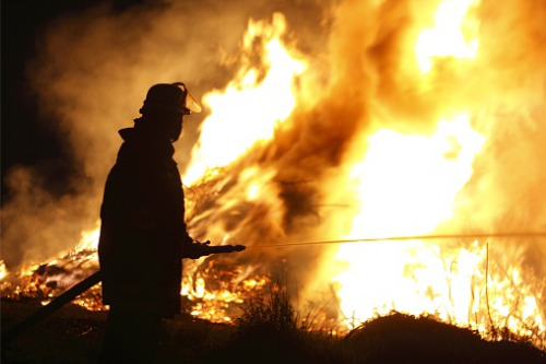
Over the past seven to eight years, Young explains, wildfire observers have seen a “rapid escalation” in the amount of losses associated with wildfires – something that concerns insurers because it makes it more difficult to predict the future based on past losses.
Young says there are two things contributing to these increases in both wildfire losses and the uncertainty surrounding where and when they’ll strike, and how severe losses will be when they do.
“In Canada, just like in the US, we’re always building new houses,” he said. “Those houses have to be somewhere, and - depending on where you are in Canada - they are on the edges of cities where you can get wildfire risk. More houses on the ground equals more risk.”
On top of that, he says, you have the observable impacts of climate change on the factors that lead to increased wildfire risk. “Hotter, drier weather, longer periods of drought, the effects of that on forests, how that spawns disease in trees and creates more fuel… all those things are exacerbating aspects that increase the severity of fires that could occur.”
About six years ago, Young and his team started working on wildfire models in general, focusing first on the US and using data sets available there. Now, on the five-year anniversary of the Fort McMurray wildfires that proved to be the costliest disaster for insurers in Canadian history, RMS has
released the RMS Canada Wildfire HD Model as part of its North America Wildfire HD Model Suite on RMS Risk Modeler.
With the addition of this region to the model, users can understand how individual locations in Canada will be impacted by a wildfire event, and they can gain a better understanding of the complex behaviours that characterize fire spread, ember accumulation, fire ignition, and smoke dispersion.
RMS partnered with top insurers, mitigation experts, and government agencies to build the model and ensure that the data, calibration, and scope addresses existing market gaps. This includes hundreds of millions of dollars of granular claims data that informed the calibration of 18 site-level adjustment features. In addition, the model explicitly simulates ember travel that goes beyond traditional fuel-based fire spread simulation techniques.
“Events such as Fort McMurray can threaten insurers with insolvency and point to the need to drill down into the wildfire risk, especially in the wildland-urban interface,” Young said. “These black-swan, long-tail scenarios require analysis of potential risk accumulations, to provide reassurance to regulators, and must be managed through better risk selection and pricing.”