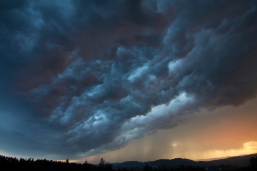
In the days following Hurricane Florence’s assault on the south-eastern coast of the US, some experts are already predicting $2.5 billion in insured losses.
However, this wasn’t the season’s first severe storm – Lane hit Hawaii just a few weeks before and while the devastation wasn’t as significant on the island, the hurricane did outpace Florence in some metrics.
“One thing in common between the two hurricane events is that they produced a huge amount of rainfall within their affected inland areas. Hurricane Lane produced about 52 inches of rainfall in some areas in the Hawaiian islands, and Hurricane Florence dumped over 30 inches of rainfall on the North Carolina coast,” said Wei Du, principal scientist at CoreLogic.
Despite the volume of rain, differences in watershed characteristics, terrain conditions, and populations between the two regions meant that Hurricane Florence became a more intense inland flood producer that inflicted major damage to property. By comparison, Hurricane Lane’s total flood damage was a drop in the bucket.
“The Wailuku River watershed and surrounding areas on the island of Hawaii received the highest rainfall amounts during Hurricane Lane. The Wailuku is the longest river on the island, with only a 28-mile length. The river starts at a 10,800-foot elevation, having extremely steep slopes,” explained Du. “On average during flooding, the velocity of the river flow can be as fast as 10 miles per hour or more. The violent flash floods generated by heavy rainfall events on the island can flow into the ocean within several hours. Since storm water comes and goes quickly in the islands, the multi-day accumulated rainfall becomes an ineffective measure for inland flooding.”
In the Carolinas and Virginia, rainfall produced by Florence covered large areas, and the total size of involved catchment areas – from which rainfall eventually flows into a body of water – will end up being many times bigger than the total area of the Hawaiian islands, added Du.
“The larger catchment areas receive larger storm water volumes. During the first three days of Hurricane Florence’s impact, the heavy rainfall areas induced by the hurricane had penetrated over 150 miles inland from the North Carolina coastline,” said the CoreLogic scientist.
Land elevation is also a critical difference between the two affected regions. The areas hit by Florence are less than 500 feet above sea level, and the rivers in North Carolina have gentler slopes so floodwater travels through North Carolina’s rivers much more slowly. Meanwhile, Du told Insurance Business that the watersheds on the Hawaiian islands resemble upside-down bowls, so when heavy rain falls, it’s divided and flows in all different directions.
“In the watersheds of North Carolina, rivers flow generally southeastward, and storm water accumulates downstream and in low land areas, causing significant flood inundation and longer flooding duration,” said Du. The longest river in North Carolina, Neuse River, is 275 miles in length, and compared to the Wailuku River in Hawaii, where flood elevations started falling on the second day of Lane’s impact, the water level in the Neuse was still climbing after five consecutive days and hadn’t yet reached its crest as of September 18.
“This indicates that flooding in some areas may persist or worsen for an additional one or two days,” said Du.
Finally, while Hawaii is no ghost state, there are 7.2 times more people and nearly 10 times more properties in North Carolina compared to the islands. According to Du, 4.7% of properties in North Carolina are within the FEMA Special Flood Hazard Areas (SFHAs) and 4.4% of the properties are in areas where the land is elevated within five feet above the 100-year flood elevations.
“As our analysis indicates, the rainfall produced by Hurricane Florence in some areas has reached over the 500-year level, so that it can create flood inundation areas beyond the SFHAs in some communities,” said Du.
Hurricane Florence revealed the severity of flood risk in the US. Learn more about the issue during the Flood Risk Summit in Miami on November 29.