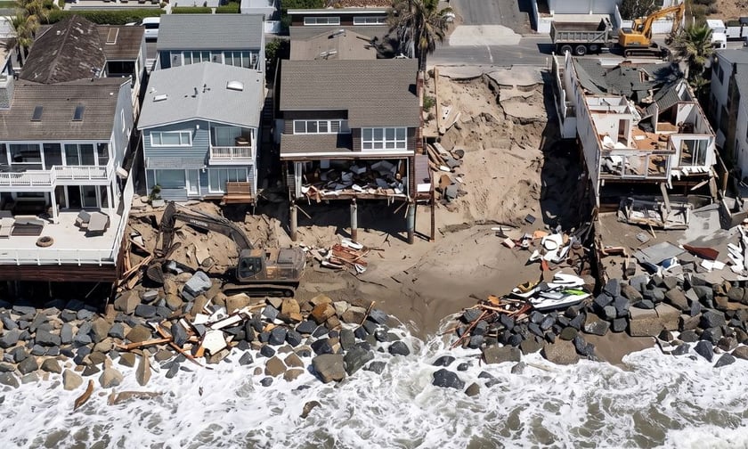
The storm damage that tore through Long Beach, Dana Point and Malibu over Labor Day weekend wasn't a California-only story. The same El Niño mechanics driving it are now pushing a slow-moving swell of unusually warm water up the Pacific coast, and it isn't going to stop at the border.
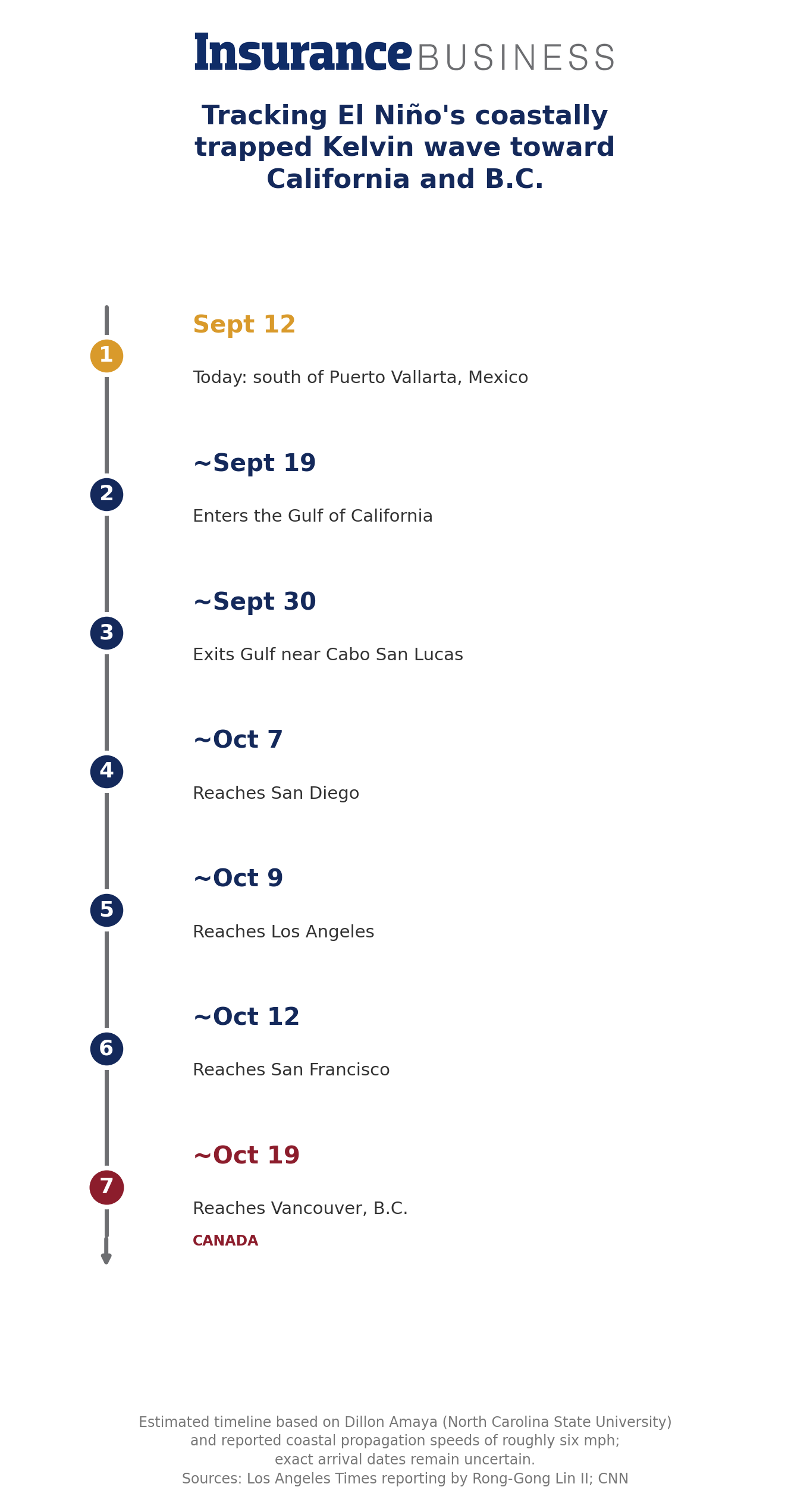
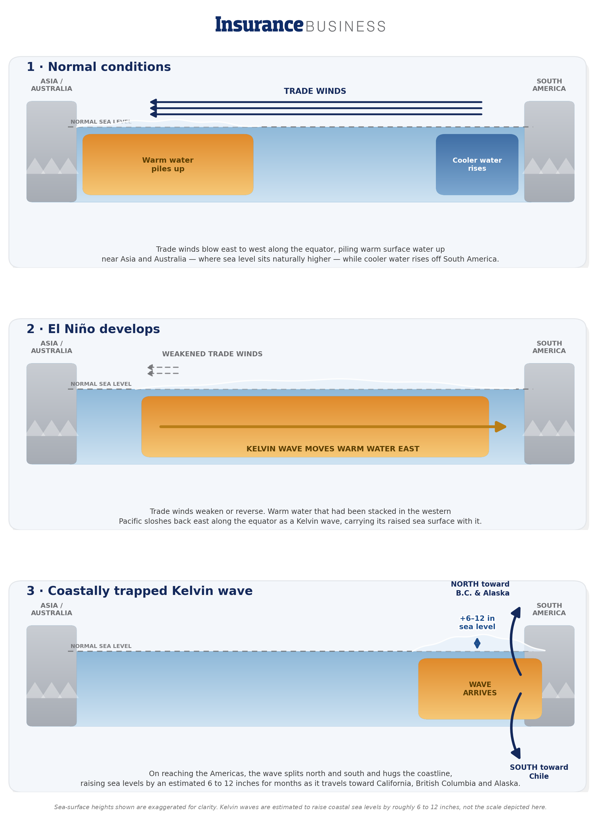
A coastally trapped Kelvin wave, a surge of warm water tied to this year's strengthening El Niño, is working its way north from Mexico's Baja Peninsula toward California, where it's expected to raise sea levels by 6 to 12 inches for months once it arrives in early October.
Research on past El Niño events shows these waves don't stop at San Francisco either: they've been tracked propagating at 2 to 3 metres per second all the way to the Aleutian Islands, hugging the coastline the entire way, which means British Columbia's coast is squarely in its path in the weeks after it passes California.
The wave moves north at roughly six miles an hour and shifts direction once it makes landfall, travelling parallel to the coast rather than crashing onshore, which is why it's largely imperceptible without satellite measurement even as it steadily raises the baseline water level beneath every high tide and storm that follows.
A temporary rise in baseline sea level doesn't sound like much next to the kind of wave damage California saw this month, but it changes the calculations on every high tide and storm surge that follows for as long as it lasts. B.C.'s South Coast and Vancouver Island have already had a preview of what a wet system layered on elevated water levels can do: a March storm this year dumped up to 120 millimetres of rain on the South Coast and 150 to 200 millimetres on parts of Vancouver Island, triggering flood watches and winter storm warnings across the province. And the 2024 atmospheric river that struck Southwestern B.C. from October 18 to 20 killed four people and caused roughly $110 million in property damage, a reminder of how quickly a coastal storm season can turn costly.
In Canada, unlike overland flood coverage, which now reaches roughly 94% of Canadian homes after a decade of expansion, storm surge and coastal flooding are generally excluded from home and business policies altogether. Overland water endorsements are built to respond to a river, lake or heavy rainfall overflowing onto dry land, not to the ocean itself pushing higher against the coast.
Co-operators said it is currently the only Canadian insurer offering a product, Comprehensive Water, that extends to storm surge and coastal flooding at every risk level, reaching an estimated 745,000 households as of mid-2026. For every other client on B.C.'s coastline, a storm surge claim this fall could land in the same gap Southern California homeowners just discovered the hard way.
This wave arrives at a difficult moment for Canadian insurers generally. Annual insured losses from catastrophic weather have nearly tripled, climbing from an average of $14 billion a decade between 2006 and 2015 to $37 billion between 2016 and 2025, with flood and water events now accounting for roughly 39% of the country's insured catastrophe losses, according to CatIQ data. The Insurance Bureau of Canada estimates about 1.5 million Canadian households sit in areas considered too high-risk for private overland flood coverage at all, leaving them reliant on provincial disaster assistance that typically falls well short of full replacement value. B.C. residents already worry about this more than most Canadians: 70% cite flooding as a top concern and 41% cite landslides or mudslides, well above the national average, reflecting both the province's terrain and its recent run of atmospheric river events.
Ottawa has floated a federal backstop of its own, a proposed reinsurance entity structured through a Canada Mortgage and Housing Corporation subsidiary aimed at extending affordable coverage to the highest-risk households currently priced out of the private market. It was first promised in 2019 and most recently targeted for an April 2026 launch, but as of this reporting it still hasn't materialized, leaving brokers to manage the gap with the tools currently on the market rather than wait for a federal fix.
The Kelvin wave and this fall's coastal flood risk are only part of what this El Niño means for B.C. Environment Canada modelling points to a peak sea surface temperature surge past 3 degrees Celsius above average, well beyond the 2-degree threshold that defines a "super" El Niño. That points toward a milder, drier winter with below-normal snowpack heading into spring , conditions that typically don't reshape wildfire risk until the following season, but which reinsurers and catastrophe modellers are already treating as a factor for January renewals.
It's a reminder that this El Niño isn't a single, contained event for Canadian carriers to underwrite around; it's a pattern that touches flood, storm and wildfire exposure at different points across the year.
For brokers with coastal B.C. clients, the practical move is to check three things before the Kelvin wave's effects show up locally, likely within a couple of weeks of its expected early-October arrival in California: whether a client's policy includes any storm surge or coastal flooding protection at all, whether Co-operators' Comprehensive Water product is a fit where standard overland coverage won't respond, and whether clients in flood-aware regions like the Fraser Valley understand the difference between overland water coverage and true coastal flood protection.
None of this requires a claim to go wrong before the conversation is worth having, the same swells that stripped a California boardwalk down to its pilings this month are, quite literally, still on their way up the coast